Milestones:The first human rescue and life saving enabled by space technology
This is a temporary page. The final version of this page can be found on the Engineering and Technology History Wiki
Title
First Search and Rescue Using Satellite Location Technology, 1982
Citation
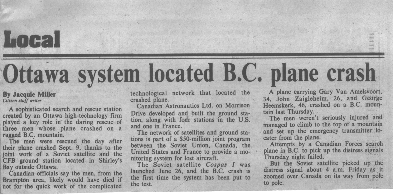
On 9 September 1982 an aircraft crashed in the mountains of British Columbia. A Canadian ground station in Ottawa located the aircraft using the COSPAS-SARSAT satellite system. Search and rescue teams were dispatched and all on board were rescued. Since the first incident, many tens of thousands of lives have been saved around the world using this technology.
Street address(es) and GPS coordinates of the Milestone Plaque Sites
Canada Aviation and Space Museum11 Aviation Pkwy, Ottawa, ON K1K 2X5, Canada, 45.458542,-75.6462657, Canada Aviation and Space Museum11 Aviation Pkwy, Ottawa, ON K1K 2X5, Canada, 45.458542,-75.6462657
Details of the physical location of the plaque
The plaque will be accommodated in the grounds of the Canada Aviation and Space Museum on a plinth or similar structure. Additionally, CASM intend to develop a large digital (possibly interactive) display which will illustrate Canada's history and achievements in space and an image of the plaque may be incorporated into this display..
How the intended plaque site is protected/secured
The grounds of the CASM are open to the public who will be able to see the plaque as they enjoy the park-like setting.The whole site is protected by the custodians of the CASM. It will not be necessary for the public to go through any security procedures to see the plaque.
Historical significance of the work
The development was motivated by the perils to aviation in the remote areas of the Canadian and US wilderness. For some years starting in the 1970s all aircraft were required to carry an Emergency Locator Transmitter (ELT) which would activate in a crash and would enable search and rescue crews to home in on a downed aircraft. However due to the need for a line of sight path between the crash site and a search aircraft the detection radius was quite limited. This resulted in lengthy and often unsuccessful searches and the consequent deaths of crash survivors. Speedy rescue is crucial to saving the lives of survivors. In the 1970s an International collaboration was established between Canada, US, the Soviet Union and later, France. This collaboration was to develop and deploy a satellite-based system which would vastly increase the detection radius for ELTs and provide a position estimate for the crash site. This would enable speedy response and rescue and thereby greatly increase the chances of survival. Canada produced a special transponder (made by SPAR Aerospace) which was fitted to an existing US TIROS weather satellite thereafter known as the SARSAT satellite. The USSR produced a similar and compatible package which was known as the COSPAS satellite. Canada also produced the ground stations (made by Canadian Astronautics Limited (CAL Corp) which detected and located the ELT. The event being commemorated was the first 'live' detection/search/rescue made using the system. The first COSPAS satellite had just been launched and the ground station located at CRC in Ottawa detected a crash in the remote mountain areas of British Columbia. The crash site was at the limit of detection distance, approximately 3000 miles. An accurate position was obtained and the crew were successfully saved. Since the first incident many tens of thousands of lives have been saved around the world using this technology.
Features that set this work apart from similar achievements
The technological obstacles to be overcome to permit the use of legacy analog ELT beacons. Early use of real-time Digital Signal Processing. The international cooperation involving the Western Powers (Canada, USA, France) and the Soviet Union during the Cold War.
This event is considered to be the first operational save using satellite position-locating data. The COSPAS and SARSAT satellites were the first to be equipped with transponders for 121.5MHz, 243MHz which are the ELT frequencies for aviation use. The COSPAS satellite had only been activated for a few days before the event and the system was still officially in its research/checkout phase, The incident in the citation was the first recorded real incident. The supporting documents confirm the event as a 'first'. The first maritime save/rescue occurred one month later involving a capsized yacht in the Atlantic ocean.
Significant references
 File:SARSAT Aerospace Canada Reduced All.pdf
File:Canadian Astronautics SARSAT Ground Station Paper.pdf
File:The COSPAS SARSAT System Paper.pdf
File:COSPAS SARSAT Demonstration Evaluation Results.pdf
File:COSPAS.flv